|
(PHOTOS ARE BELOW THE EXPLANATORY TEXT)
Seeing the Land was meant to make the twelve spies
fall in love with it and "follow after it"
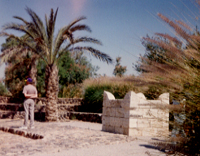
Just seeing and experiencing these places can stir up something that has long lain dormant in our spirits...
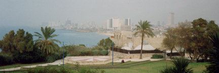
YHWH set the land of Israel apart for a very special purpose. As the only place where three continents converge,
you could call it the center of the earth--an ideal place from which His truth could spread worldwide.
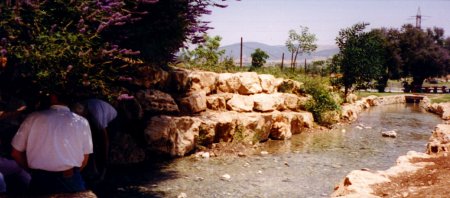
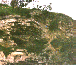
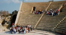
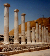
The city of Dan is a prime example of how it was to work. This outpost thrived at the northern entrance to Israel
on the only road from Assyria to Egypt, because of an abundance of water where caravans could stop.
YHWH planned it so that all the major trade routes of the ancient mideast had to pass right through this land,
so all the world could see the results of the wisdom YHWH gave them in His special revelation
and the lifestyle it entailed. This contact with other nations was meant to spread YHWH's light to them,
all too often it let idolatry gain an inroad into Israel instead.
But not always so obvious is that, just like the miracles described in the holy Book,
the features of the holy land itself often illustrate mankind's need and YHWH's redemption.
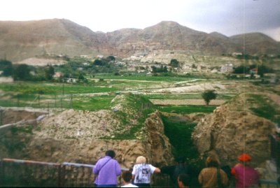
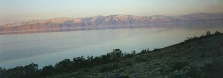
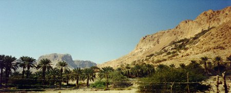
On its eastern border is the Dead Sea. Petroleum deposits from deep beneath it used to rise to the surface
and be ignited by lightning, so it was called the "lake of fire". An earthquake in 1840 sealed off that seepage
--but it seems that another earthquake, when the Messiah sets His foot on the Mount of Olives...will open it up again!
But for now, it is the lowest point on the earth's surface, 1,300 feet below sea level,
3,000 feet lower than nearby Jerusalem (which symbolizes heaven),
and having no outlet, it is an apt picture of the Lake of Fire that is "reserved for the devil and his angels".
Like the prophets before Him, the Messiah Himself also used the Valley of Hinnom, or Ge-henna,
to illustrate Hell. Used as a rubbish dump because earlier infant sacrifices there had made it unworthy of nobler use,
fires were kept burning there day and night. Judas went directly from the symbol to the reality, for it was in this valley
that he hanged himself in remorse for receiving the thirty pieces of silver
that eventually paid for the Potter's Field itself.
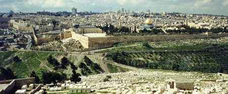
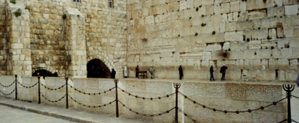
But that valley also forms part of something amazing. The first letter of Elohim's name,
Shaddai, was also written right into the topography of the capital city! He called it the "place where I have set My name".
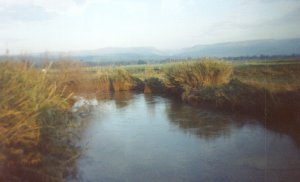
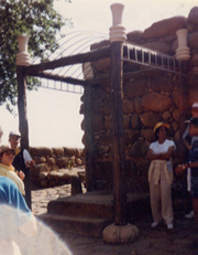
From a careful study of the rivers mentioned in Genesis chapter 2, one of which is the Gihon,
the location of Eden itself may have been none other than the site of Jerusalem, the future capital of the whole world!
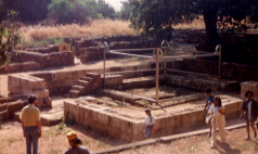
Solomon, whose reign foreshadowed the Messiah's peaceful kingdom,
was crowned at the spring of Gihon, and King Hezekiah channeled the Gihon under the city to form
an internal water source in times of siege--a picture of the Holy Spirit, who can keep providing for us in any circumstance.
That reservoir is the pool of Siloam, where a man who was born blind found healing when Yahshua sent him there.
The Hebrew name for Siloam (Shiloach) means "sent"!
As Gershon Salomon, who attempted to lay the cornerstone for the next Temple in the early 1990's,
is fond of saying, ...this is no ordinary place!
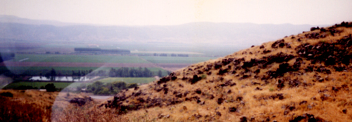
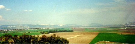
Israel's topography has 3 distinct "belts":
the coastal lowland, or Sh'phelah, called the Plain of Sharon further north,
the mountains that form the country's "backbone", and
the Rift Valley, a deep gash that extends from the Jordan River's source in Syria, all the way to southern Africa.
It can even be seen from the moon!
Israel's major regions are:
the lush, green Galilee,
the infamous Golan Heights,
Samaria,
Judea, and
the Negev, that barren wilderness in the South.
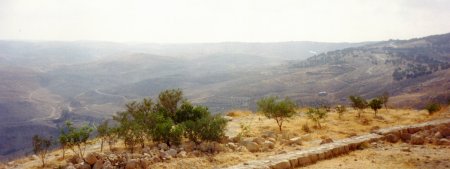
Jerusalem is just west of the Dead Sea, nestled in the mountains between Judea and Samaria.
On the Sh'phelah, between the Mediterranean and the mountains,
stood a series of fortress cities guarding the only route by which Jerusalem could be easily attacked.
Lachish was the strongest of them all--a majestic city with lush vineyards then as now.
It "plugged" the entrance to the important city of Hevron,
but since Lachish had been "the beginning of sin to the daughter of Tzion"--a foot in the door
for idolatry to spread throughout Israel--even it had to fall.
From Lachish you can easily see the tel of Azekah, and
it becomes clear how they were able to send warnings from one fortress to another with light signals.
GEOGRAPHICAL CHANGES IN THE LAND
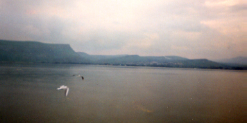
The Valley of Siddim is described in Scripture as having been well-watered.
Now it is as dry as dust and desolate, and in it lies the Dead Sea--
so salty that nothing can live in it. Hardly a place Lot would want to pasture his flocks in now.
But the Dead Sea was not always there. In fact,
the Jordan River apparently used to flow all the way into the Gulf of Aqaba (the eastern branch of the Red Sea).
A different orbit that Mars held until 701 B.C. (often crossing earth's path quite closely)
served as the cause of a series of several later biblical catastrophes like an axis wobble that in some locations could
make the sun appear to stand still (Joshua 10; Isa. 38:8).
It also opened the Great Rift so that Sodom and Gomorrah's valley sank down into it when the
equatorial bulge had to shift position so rapidly
that it simply tore a gash in the earth's surface that spans a full 50 degrees of latitude.
[Patten, Hatch, and Steinhauer, The Long Day of Joshua and 6 Other Catastrophes, Seattle:
Pacific Meridien, 1973; Donald Patten, The Biblical Flood and the Ice Epoch, Pacific Meridien, 1966]
It released volcanic processes to act on the petroleum tar and sulphur that were in the area and caused
what was probably a nuclear-scale blast.
The 1,300-foot deep crater effectively blocked the outflow of the Jordan
and the minerals and natural salt reserves built up so heavily that you can effortlessly float on the top.
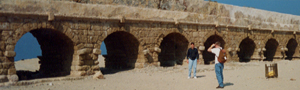
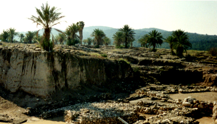
Volcanic ash is still visible at the tel of Beth She'an, though there have been
no active volcanoes here for centuries.
Another important problem is solved when we consider such cataclysmic geophysical changes.
Archaeologists have found that while the Second Temple faced due east,
the first, Solomon's was aligned 6.2 degrees north of due east.
The first Temple was built before the Mars encounter in 701 B.C., the second after it.
Computer simulations of that event suggest that there may have been about a
6.5-degree rotation in the earth's axis. In other words,
there was actually a change in what was due east between the constructions of the two temples.
[Don Stewart and Chuck Missler, The Coming Temple. Orange, CA: Dart Press, 1991]
This would also explain why a land "flowing with milk and honey" is so barren today.
Part of this, of course, was accomplished by overgrazing by sheep as well as deforestation.
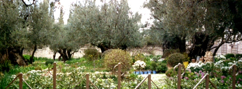
The Romans cut down all the trees on the Mount of Olives (though many grew back from the same roots),
and when the Turks ruled the land they taxed people according to how many trees were on their land.
So many cut their own trees down, causing major erosion.
But a shift of 6 to 6.5 degrees would have chanegd the climate of Israel from one paralleling northern California
to one very much like that of southern California. It is definitely the latter now.
Northern California is where the redwood trees grow, and this could explain why the cedars of Lebanon grew so large
when today they are few and, while large, do not break world-class records.
In other words, at the time of the conquest under Joshua, Israel would have been so lush that other nations would fight for it.
We can see examples in the huge cluster of grapes found in the Valley of Eshqol.
The Israelis have accomplished some impressive re-agriculturalization through irrigation and other ingenious methods,
but nothing like that!
This may suggest what the now not-so-attractive land will be like in the Kingdom--
the "time of the restoration (restitution) of all things".
|